Flames of the Levant — Interactive World Map
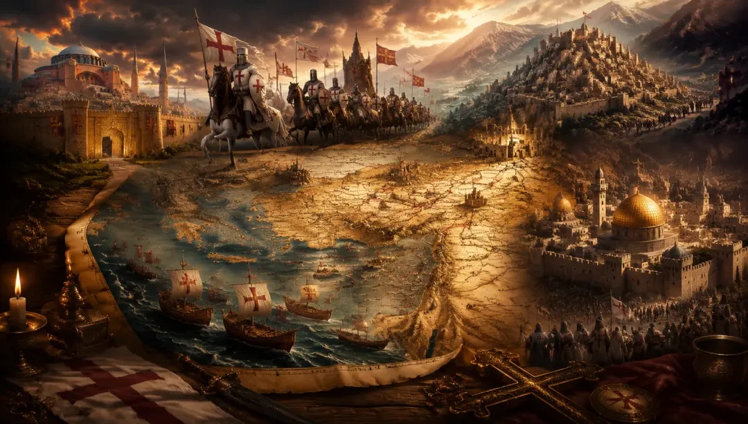
Open Flames of the Levant — Interactive World Map: a browser-based parchment atlas of the First Crusade Eastern Mediterranean with 16 real location markers, 66 points of interest, real transparent marker sprites and generated detail-map panels, built end-to-end in Neta Studio.
Final Product: Flames of the Levant — Interactive World Map
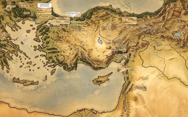
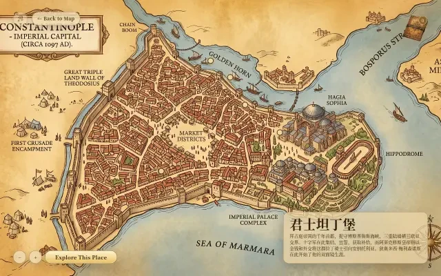
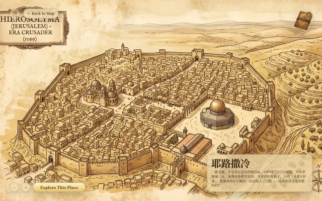
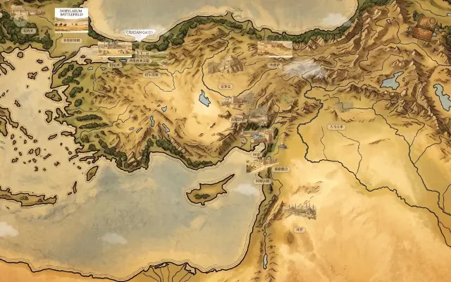
Flames of the Levant — Interactive World Map (黎凡特之焰 地图) is a browser-based interactive map of the Eastern Mediterranean during the First Crusade (1096–1099), told from the diplomatic angle of the Byzantine court. It pins 16 real historical anchors onto a hand-painted parchment atlas — from the Golden Gate of Constantinople and the siege lines of Nicaea, through Dorylaeum and the Cilician Gates, to the walls of Antioch, the harbours of Acre and Tripoli, the holy city of Jerusalem and the Fatimid capital of Cairo.
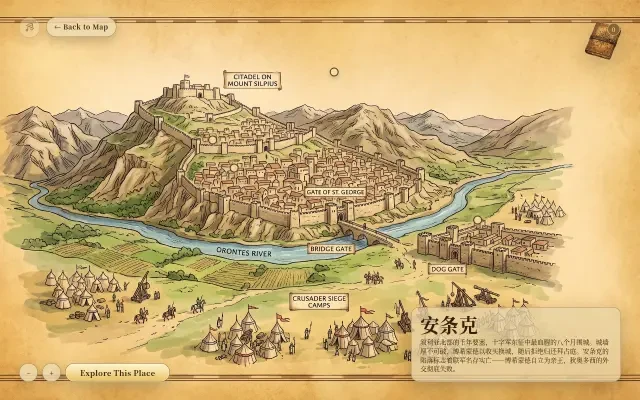
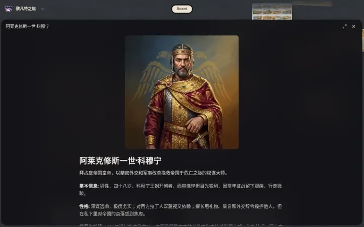
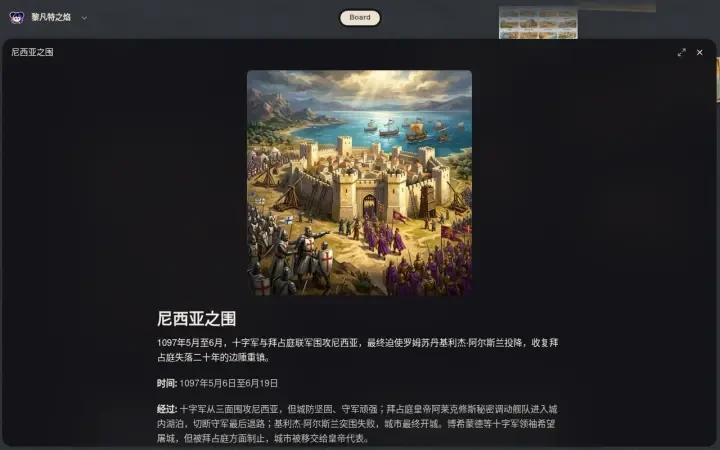
Drag to travel across the map, wheel or tap to zoom, and click any marker to fly in and open its card: a dedicated detail-map artwork, the location’s story as witnessed through the eyes of the Byzantine diplomat Theodosios Melissenos, and 66 points of interest spread across the atlas — the Theodosian Walls and the Great Palace at Constantinople, the Dome of the Rock and the Church of the Holy Sepulchre in Jerusalem, the citadel above the Orontes at Antioch.
From a one-line seed about the Crusades, Neta Studio generated the entire canon-consistent world — and then this complete interactive map, with real map art, real transparent marker sprites and real prompts, in minutes.
Open the map: Flames of the Levant — Interactive World Map →
Features
- 16 Historical Anchors, Pinned to the Crusader Levant — Constantinople, Nicaea, Dorylaeum, Konya, Tarsus, the Cilician Gates, Antioch, Edessa, Tripoli, Beirut, Acre, Jerusalem, Ascalon, Damascus, Cairo and Rhodes — every marker placed over a geography-first parchment base map of the real Eastern Mediterranean, from the Black Sea coast to the Nile Delta.
- 66 Points of Interest in Detail Panels — Click any marker to open its card: a dedicated detail-map artwork plus period story copy and 4–5 explorable points each. Constantinople alone lists Hagia Sophia, the Theodosian Walls, the Golden Horn, the Great Palace and Blachernae; Jerusalem opens with the Dome of the Rock and the Church of the Holy Sepulchre.
- Drag, Zoom & Fly In — Pan the parchment atlas with your cursor, zoom with the +/− controls or the scroll wheel, and click any marker to fly straight to the location with a smooth focus zoom.
- Real Asset-First Art Pipeline — Every marker is real generated artwork: a clean geography-only parchment base map, sixteen location scenes generated together on one 4×4 sheet, each cut out into a transparent PNG sprite, and a separate detail-map panel produced for every location.
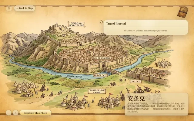
- A Living Chronicle of the Crusade — A travel journal records every place you explore, an “Explore This Place” experience opens each scene in depth, and drifting cloud shadows, roaming bird silhouettes and a background-music toggle make the old parchment feel inhabited rather than static.
- Runs in Any Browser — A single static page, published with one click and shared instantly — no download, no install. Open the link on desktop or mobile and start walking the roads of the First Crusade.
Interface
Production Process Breakdown
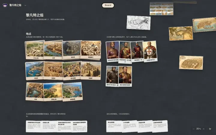
From the one-line seed “做一个十字军东征世界” (build a Crusades world), Neta Studio shapes 黎凡特之焰 — Flames of the Levant — through the Byzantine diplomatic lens of the First Crusade: 32 atom cards — 6 characters (Alexios I Komnenos, Bohemond of Taranto, Godfrey of Bouillon, Kilij Arslan I, the diplomat Theodosios Melissenos and the Venetian broker Peter Chrysologos), 16 locations, 5 events and 5 factions — with the world’s semi-realistic, painterly splash-art style locked in as the art direction for the map.
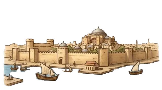
The map is produced asset-first as layered production art: a clean geography-only parchment base map of the Eastern Mediterranean (no labels, no markers, no UI), a 4×4 sheet of sixteen location marker scenes generated in one pass, each marker cut out to a transparent PNG sprite, and sixteen detail-map panels generated per location from their own point-of-interest specs.
The map app is assembled from a single location dataset — markers positioned on the base map, legend and travel journal wired up, and each detail card connected to its artwork and points of interest — then packaged as a static web page, published to a stable link and shared instantly. No coding required.
Asset Prompts
Real Generation Prompts
"Create a clean illustrated world map for the Eastern Mediterranean and Levant during the First Crusade era (1096-1099). Show geography only: coastlines, rivers, lakes, mountains, forests, plains, deserts, seas, and regional terrain. The map covers from Constantinople and the Aegean Sea in the west to Jerusalem and Damascus in the east, from the Black Sea in the north to Egypt in the south. Key geographic features: the Bosporus strait, the Anatolian plateau with rugged mountains, the Taurus Mountains, the Syrian desert, the Lebanese coastal range, the Jordan River valley, the Sinai desert, the Nile delta, the Mediterranean Sea. Style and presentation: rendered in a vintage parchment atlas style with warm golden-brown tones, soft edge falloff, aged paper texture, subtle ink linework for coastlines, painterly terrain shading, classical map aesthetic. Geography and layout: based on the layout reference image provided. This must be a clean terrain surface for later location overlays. CONTENT ISOLATION (critical): The style reference image is for RENDERING STYLE ONLY — its material, palette, texture, edge treatment. The style reference's specific terrain MUST NOT appear in this map. Do not copy or echo any of these from the reference image: its volcano or volcanic landscape, its mountain silhouettes or distinctive peaks, its coastline shapes, bays, or peninsula outlines, its river paths or forest shapes, any landmass silhouette that matches the reference. This new world has its own geography. Only borrow the LOOK, never the TERRAIN. Do NOT draw any of these on the map: settlement, city, town, or village symbols; castle, tower, fortress, ruin, or landmark icons; named place dots, pins, stars, or location markers; place-name labels or any text; roads, paths, or route lines; gold rings, highlight circles, or selection halos; location patches or cutout art; grid overlays, coordinates, or debug marks. Only geography. The map must read as an empty terrain canvas, not a populated atlas."
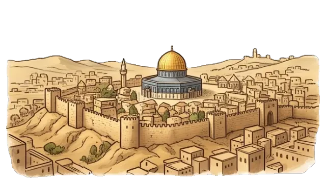
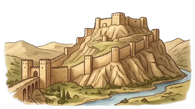
"Generate a 4x4 grid of sixteen stylized location marker-scenes for a historical Crusades-era world map of the Eastern Mediterranean. All sixteen cells must share ONE cohesive rendering style: warm golden-brown vintage parchment tones, soft ink linework, subtle painterly shading, aged atlas aesthetic — the same visual family as a classical illustrated world map. Each cell must represent a DIFFERENT real historical location as a compact, highly recognizable icon-scene. Every cell MUST have a clean flat WHITE background — no scenic backgrounds, no sky, no horizon, no textured backdrops. Each landmark must appear directly on white as its own iconic silhouette. ABSOLUTELY FORBIDDEN in every cell: circular frames, round medallions, badge borders, rings, halos, enclosing shapes, vignettes, shadow discs, or any border around the landmark. Only the landmark itself on white. The 16 locations, in reading order: Cell 1: CONSTANTINOPLE — massive triple land walls, domed Hagia Sophia silhouette, Golden Horn harbor with ships, Bosporus water. Cell 2: NICAEA — walled city on a lake shore, Roman towers, water reflections. Cell 3: DORYLAEUM BATTLEFIELD — open steppe valley with hills, cavalry silhouettes, dry grass, dust clouds. Cell 4: KONYA — plains city with Seljuk domes and minarets, surrounding tents and yurts, open Anatolian steppe. Cell 5: TARSUS — Roman stone ruins with arches, fertile plain with orange groves, small ancient harbor. Cell 6: ANTIOCH — massive mountain fortress, towering walls climbing a steep hill, citadel on peak, river below. Cell 7: EDESSA — hilltop fortress city, arid Mesopotamian landscape, church tower, distant Euphrates. Cell 8: TRIPOLI — coastal fortress with harbor, palm trees, mountain backdrop. Cell 9: ACRE — crusader stone harbor with ships, thick walls meeting the sea, lighthouse. Cell 10: JERUSALEM — walled city on hills, prominent Dome of the Rock, dense stone buildings, arid terrain. Cell 11: ASCALON — coastal fortress on sandy plain, palm groves, Mediterranean waves. Cell 12: DAMASCUS — white-walled city amidst green oasis orchards, grand mosque dome, desert edge beyond. Cell 13: CAIRO — Nile riverbank city, many minarets and domes, green delta strip beside desert. Cell 14: RHODES — island fortress with Byzantine harbor chain, lighthouse, Greek walls set in blue sea. Cell 15: CILICIAN GATES — narrow mountain canyon pass, towering limestone cliffs on both sides, rocky path winding through. Cell 16: BEIRUT — ancient Phoenician stone harbor, waterfront walls, Lebanese mountain slope behind. All sixteen cells must look drawn by the same hand in one pass. The grouped sheet must have a clean white background throughout so each cell is easy to review, split, and cut out."
"Create a dedicated local detail view for CONSTANTINOPLE during the First Crusade era (1096-1099). This should be a rich, explorable view of the Byzantine imperial capital — the great triple land walls of Theodosius, the domed Hagia Sophia, the Golden Horn harbor with ships, the Bosporus strait dividing Europe from Asia, the imperial palace complex, and the crowded market districts. Style: painted in warm golden-brown vintage parchment tones matching a classical illustrated world atlas. Preserve strong spatial readability with enough negative space for UI overlays and labels. Support 4-5 distinct points of interest. This run is for one location only. Do not merge multiple locations."
Why Choose Neta Studio
Professional — The cloud harness system supports the full workflow from world building to interactive app publishing, all running in the cloud with no local setup. Stable access to the latest models, including GPT Image 2 for art generation.
One-click generation — Officially tuned skills drive every step: world building, map & game design, art generation, app packaging. World fork resource sharing lets any public world become the start of something new.
Community-first — Users build unlimited worlds; all public worlds can be forked, remixed and reimagined — and every generated world ships with a real, playable result, like this map.
Studio Interior
Start Exploring
This interactive world map was generated by Neta Studio AI from a single sentence. The world took minutes. The map took minutes. You can do it too — adapt this world or start fresh from any IP. No coding required, free to start.