Wizarding Britain — Interactive Atlas
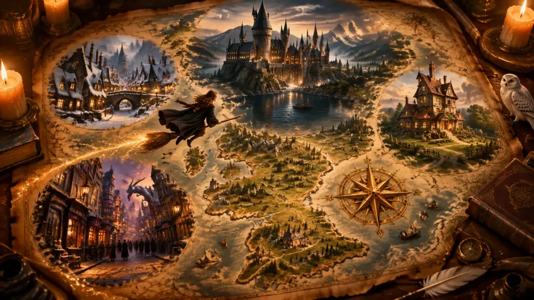
Open Wizarding Britain — Interactive Atlas: a browser-based map of hidden magical Britain with 16 anchor locations, 79 points of interest, real marker sprites and generated detail maps, built end-to-end in Neta Studio.
Final Product: Wizarding Britain — Interactive Atlas
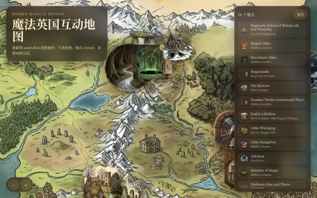
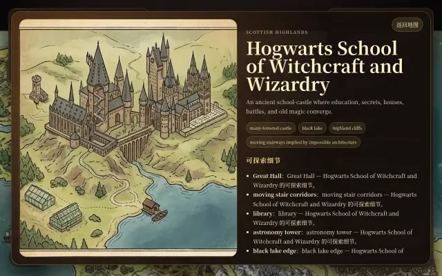
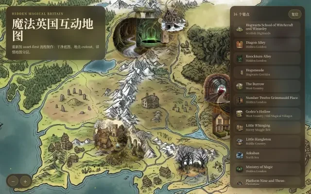
Wizarding Britain — Interactive Atlas (魔法英国互动地图) is a browser-based interactive map of the hidden magical Britain of the Harry Potter world. It pins 16 anchor locations onto a clean parchment atlas of the British Isles — from Hogwarts School of Witchcraft and Wizardry in the Scottish Highlands and the secret shopping lanes of Hidden London, to Azkaban on its North Sea rock and the Shrieking Shack at the edge of Hogsmeade.
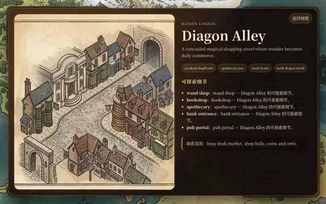
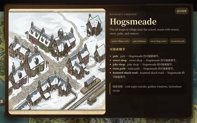
Drag to travel across the map, wheel or tap to zoom, and click any marker or legend row to fly in and open its card: a dedicated detail-map artwork, its signature features, and 79 points of interest — the Great Hall and the Black Lake edge at Hogwarts, the wand shop and bank portal in Diagon Alley, the joke shop and haunted-shack road in Hogsmeade.
From a one-line seed about the wizarding world, Neta Studio generated the entire canon-aligned world — and then this complete interactive atlas, with real map art, real marker sprites and real prompts, in minutes.
Open the atlas: Wizarding Britain — Interactive Atlas →
Features
- 16 Anchor Locations, Pinned to Britain — Hogwarts, Diagon Alley, Knockturn Alley, Hogsmeade, the Burrow, Grimmauld Place, Godric's Hollow, Little Whinging, Little Hangleton, Azkaban, the Ministry of Magic, Platform Nine and Three-Quarters, the Forbidden Forest, the Chamber of Secrets, the Astronomy Tower and the Shrieking Shack — every marker placed over a geography-first base map of the real British Isles.
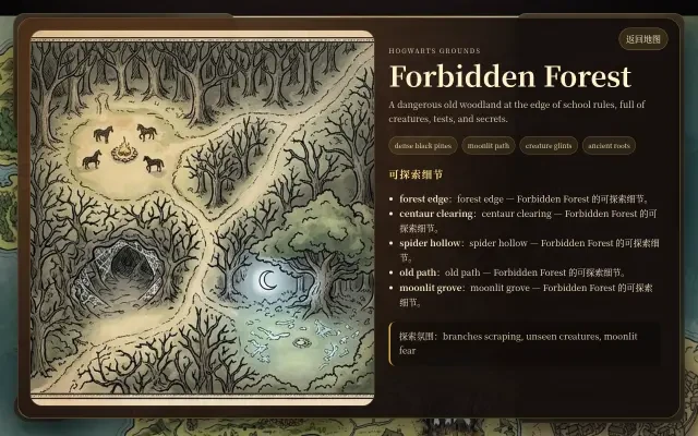
- 79 Points of Interest in Detail Panels — Click any marker to open its card: a dedicated detail-map artwork plus signature features and 3–6 points of interest each — for Hogwarts alone that means the Great Hall, the moving stair corridors, the library, the Astronomy Tower and the Black Lake edge.
- Drag, Zoom & Fly In — Pan the parchment atlas with your cursor, zoom with the +/− controls or the scroll wheel, and tap any legend row to fly straight to the location with a smooth focus zoom.
- Real Asset-First Art Pipeline — Every marker is a real generated artwork: a clean geography-only base map, 16 location scenes generated together on one 4×4 sheet, each cut out into a transparent PNG sprite, and a separate detail map produced for every location.
- A Living Parchment Atmosphere — Drifting golden sparks, a candle-warm storybook palette, an animated reveal screen and gentle hover states make the old atlas feel inhabited rather than static.
- Runs in Any Browser — A single static page, published with one click and shared instantly — no download, no install. Open the link on desktop or mobile and start exploring hidden Britain.
Interface
Production Process Breakdown
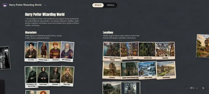
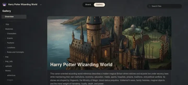
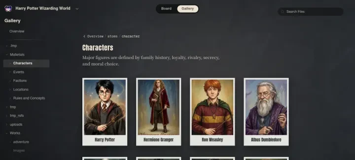
From the seed prompt about a hidden magical Britain, Neta Studio builds the canon-aligned Harry Potter Wizarding World: 45 atom cards — 10 characters, 10 locations, 11 events, 9 rules and concepts, 5 factions — with the world's classic fantasy illustration / vintage storybook style locked in as the art direction for the atlas.
The map is produced asset-first as layered production art: a clean geography-only parchment base map of Britain (no labels, no markers, no UI), a 4×4 sheet of 16 location marker scenes generated in one pass, each marker cut out to a transparent PNG sprite, and 16 detail-map panels generated per location from their own point-of-interest specs.
The atlas app is assembled from a single locations data file — markers positioned on the base map, the legend grouped by region, and detail panels wired to each location's detail map — then packaged as a static web page, published to a stable link and shared instantly. No coding required.
Asset Prompts
Real Generation Prompts
"Create a clean illustrated world atlas base map for a hidden magical Britain setting, using the attached parchment fantasy atlas image ONLY as the style/presentation reference and the attached rough British Isles layout image ONLY as the geography/layout reference. Content authority: the current world is a secret magical society layered over Britain. Geography should read as Britain and nearby sea, with a Highland school region in the north, hidden London district region in the southeast, West Country family/history region in the southwest, a northern ancestral village corridor, and a remote North Sea prison island. Artifact type: clean production base map. Strictly no location marker-scenes, no labels, no readable text, no gold rings, no route lines, no UI, no debug dots, no character portraits, no logos, no franchise emblems. Visual style: vintage storybook fantasy cartography, aged parchment, inked coasts, subtle terrain relief, low mist, forests, moors, river hints, sea texture, ancient and mystical but still clearly a map object. Leave enough negative space for separate cutout location assets to be overlaid later. Do not copy place names or geography from the style reference. Use the style reference for material, color, edge falloff, and illustration language only. Use the layout reference for broad placement only, but remove all its markers and labels."
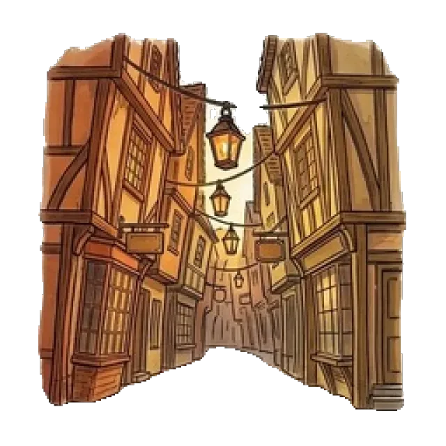
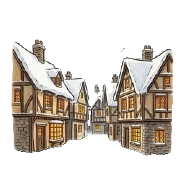
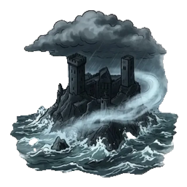
"Use the attached faint 4×4 grid only as spatial layout guidance. Create one square 4×4 asset sheet with exactly 16 compact location marker-scenes, one centered scene per cell, white or near-white background, no visible grid, no text, no labels, no UI, no watermark, no logo. Cohesive vintage storybook fantasy atlas style, warm parchment palette, inked silhouettes, consistent lighting and scale, cutout-friendly. Row-major slot order: 1 ancient many-towered magic school castle above black lake; 2 crooked hidden magical shopping alley; 3 dark cursed side alley with green lamps; 4 snowy all-magical village; 5 leaning stacked countryside family house; 6 narrow hidden black townhouse; 7 old village churchyard and cottages; 8 neat suburb street with subtle owl; 9 bleak manor hill and graveyard; 10 stormy prison fortress on sea rock; 11 underground magical government atrium with green fireplace arches; 12 steam train platform behind brick portal; 13 moonlit forbidden forest edge; 14 underground serpent chamber; 15 high astronomy tower with moon; 16 crooked abandoned snowy shack. Keep every scene fully inside its cell, separated, complete, not cropped, and do not reproduce grid marks."
"Hogwarts School of Witchcraft and Wizardry — detail map for the atlas card. Subject: a local explorable castle-and-grounds map. Composition: isometric parchment campus plan. Must include: Great Hall, moving stair corridors, library, astronomy tower, black lake edge. Cohesive vintage storybook fantasy atlas style matching the base map."
Why Choose Neta Studio
Professional — The cloud harness system supports the full workflow from world building to app publishing, all running in the cloud with no local setup. Stable access to the latest models: Claude Opus 5, GPT Image 2, DeepSeek V3.
One-click generation — Officially tuned skills drive every step: world building, map & game design, art generation, app packaging. World fork resource sharing.
Community-first — Users build unlimited worlds; all public worlds can be forked, remixed, reimagined.
Studio Interior
Start Exploring
This interactive web app was generated by Neta Studio AI from a single sentence. The world took minutes. The atlas took minutes. You can do it too — adapt this world or start fresh from any IP. No coding required, free to start.